Impervious Surfaces Maps
Working with the University of Vermont’s Spatial Analysis laboratory, Tukman Geospatial has produced impervious surfaces maps in Sonoma, Marin, San Mateo, Santa Cruz, Santa Clara, Alameda, and Contra Costa Counties.
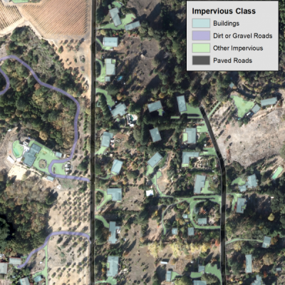
The impervious maps are a fine-scale polygon vector representation of all artificial impervious surfaces in the county, with an MMU of around 400 square feet.
The impervious maps are created using “expert systems” rulesets developed in Trimble Ecognition, followed by manual editing. These rulesets combine automated image segmentation with object-based image classification techniques. In contrast with machine learning approaches, expert systems rulesets are developed heuristically based on the knowledge of experienced image analysts. Key data sets used in the expert systems rulesets for impervious mapping include: orthophotography, the LiDAR point cloud, and LiDAR derived rasters.
Tukman Geospatial workswith UVM to develop the mapping classification and methods, and to provide QA/QC on the deliverables. The UVM team performs the actual mapping in Ecognition and the manual editing that follows.
The impervious surface maps are very useful to understand the distribution of non-burnable impervious surfaces on the landscape, as well as the locations of structures.
The impervious surfaces maps for all of the counties are freely and publicly available at http://pacificvegmap.org.