Wildfire Fuel Mapper
In 2022, Tukman Geospatial and partners Pepperwood Preserve and the University of California Agriculture and Natural Resources (UCANR) completed the Sonoma County Wildfire Fuel Mapper, created to help landowners and managers in Sonoma County locate and understand fire hazards on their land. It provides users with a set of tools, resources, and information to reduce fire hazards on their property. For this project, Tukman Geospatial created downloadable reports and maps for each parcel over 3 acres in Sonoma County, and worked with the project partners to develop a story map and other resources.
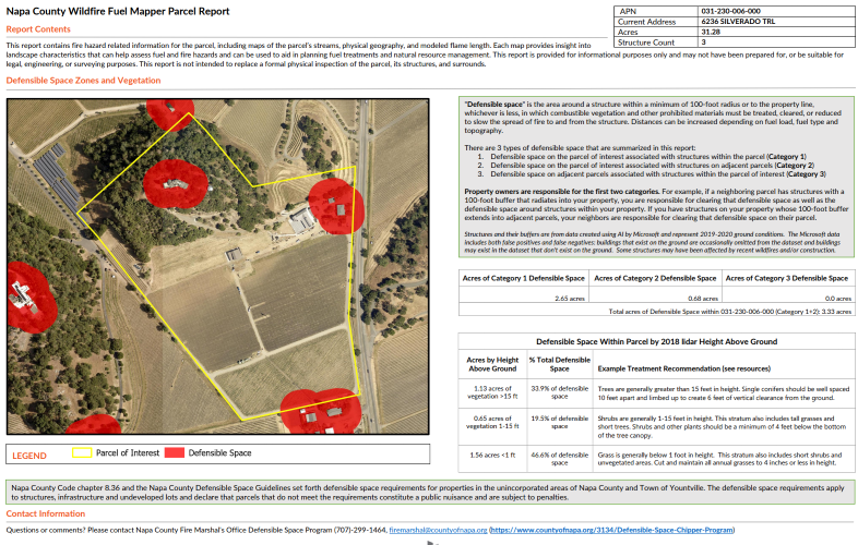
In early 2023, Tukman Geospatial completed the Napa County Fuel Mapper, and in late 2023, Tukman Geospatial completed the Fuel Mapper for Alameda and Contra Costa Counties.
Everything is accessible via a single web site – visit https://wildfirefuelmapper.org.