Story Maps and Data Access Viewers
Tukman Geospatial has develop a number of story maps (using ESRI templates and tools) that serve as outreach tools for clients, as well as javascript viewers (using ESRI’s javascript API) that provide access to data.
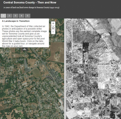
A simple example of a publicly accessible story map developed by Tukman Geospatial is this 1942 imagery swipe app that compares modern day imagery in central Sonoma Sounty to historic (1942) aerial photos.
Javascript viewers include an imagery ‘clip and email’ viewer and a contour ‘clip and email’ viewer developed for the Sonoma County Ag + Open Space District. The ‘click and email’ viewers provide easy access to imagery and LiDAR-derived 1-foot contours. In these apps, the user digitizes an area of interest, provides their email information, and submits their request. Their polygon is submitted to an ArcGIS server in the Amazon Web Services (AWS) cloud, which runs a geoprocessing script to clip the imagery or contours, and emails the user a link where they can download their clipped contours or imagery.
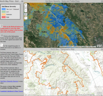
Tukman Geospatial has developed other javascript apps and story maps for clients and for internal use, including field data collection viewers, viewers for comparing pre and post-fire imagery after the 2017 North fires, viewers for visualizing burn severity after the fires, and story maps for numerous applications.
Client
Various Clients
Project Date
2009 - 2018