Santa Cruz and Santa Clara Clara Wildfire Data Products

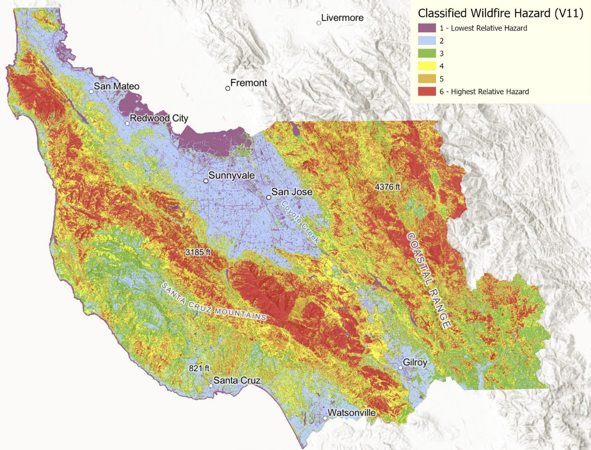
In late 2022 Tukman Geosptial completed a multi year project that produced a set of wildfire data products for Santa Cruz and Santa Clara Counties.  Funded by CAL FIRE, Datasets included an enhanced lifeform map, a 5-meter fuel model, a set of lidar derivatives including canopy cover, canopy height, and topography, and wildfire hazard and wildfire risk to structures maps.  

All datasets are publicly available at PacificVegMap.  

The final report for the hazard and risk mapping is available at this link.

Privacy Settings
We use cookies to enhance your experience while using our website. If you are using our Services via a browser you can restrict, block or remove cookies through your web browser settings. We also use content and scripts from third parties that may use tracking technologies. You can selectively provide your consent below to allow such third party embeds. For complete information about the cookies we use, data we collect and how we process them, please check our Privacy Policy
Youtube
Consent to display content from - Youtube
Vimeo
Consent to display content from - Vimeo
Google Maps
Consent to display content from - Google